SLAMTEC RPLiDAR A1M8 360 Degree Laser Range Finder – 6m (Radius Range)

Ask Our AI Assistant

Product Image
Working Principle

Description

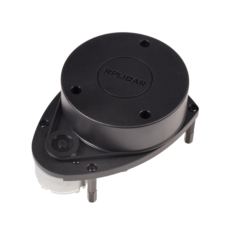
The RPLiDAR A1M8 operates using a laser triangulation measurement system. It performs a 360-degree scan to produce 2D point cloud data, which is useful for mapping, localization, and object/environment modeling.

Sensor Types

Laser Triangulation

Dos And Donts

Donts

  • Avoid Physical Obstructions: Ensure that the path of the laser is not obstructed to avoid inaccurate readings.,
  • Do Not Exceed Operational Limits: Do not use the device beyond its specified range of 0.2 to 6 meters radius.

Dos

  • Ensure Proper Calibration: Before using the RPLiDAR A1M8, ensure it is properly calibrated to achieve accurate measurements.,
  • Use In Appropriate Environments: The device can be used in both indoor and outdoor environments effectively, even without sunlight.
Limits

Environmental Conditions

  • Description: While the device works well in both indoor and outdoor settings, it is optimized for environments without direct sunlight interference.

Operational Range

  • Description: The RPLiDAR A1M8 has an operational range from 0.2 to 6 meters in radius, and 0.2 to 12 meters in diameter.
How To Connect

System Connection

  • Description: The RPLiDAR A1M8 includes an interfacing controller and connecting cable for setup. Detailed connection instructions can be found in the datasheet provided with the product.
Dimensions

Height

99 mm

Length

60 mm

Weight

170 g

Width

70 mm